
Detailed parcel analysis
Inspect constraints, land details and parcel history.
Detailed parcel analysis#
Inspect constraints, land details and parcel history.
Access: Environmental measurements are Free. Assemblage, slope, sale history, valuation and expanded building details require Pro. Data completeness differs by parcel. Flood and wetland extents may overlap and should not be added blindly. Basic identity, acreage, APN and existing CRM content remain available on Free.
Screenshots show actual Pillar views captured September 9, 2026. Environmental and slope panels use a public parcel in Newnan, Georgia; the assemblage map uses Sacramento airport parcels. Values reflect the source record at capture time; they are not measurements of your selected property.
What you get#
Expanded parcel sections bring together assemblage, environmental acreage, slope, sale history, valuation and tax, and building or land fields. Open the section you need without losing the basic parcel overview.
Try it in Pillar#
- Open a parcel card.
- Expand the relevant detailed section.
- Read available values and their source context; inspect maps or related reports for more detail.
Explore the parcel sections#
Assemblage analysis#
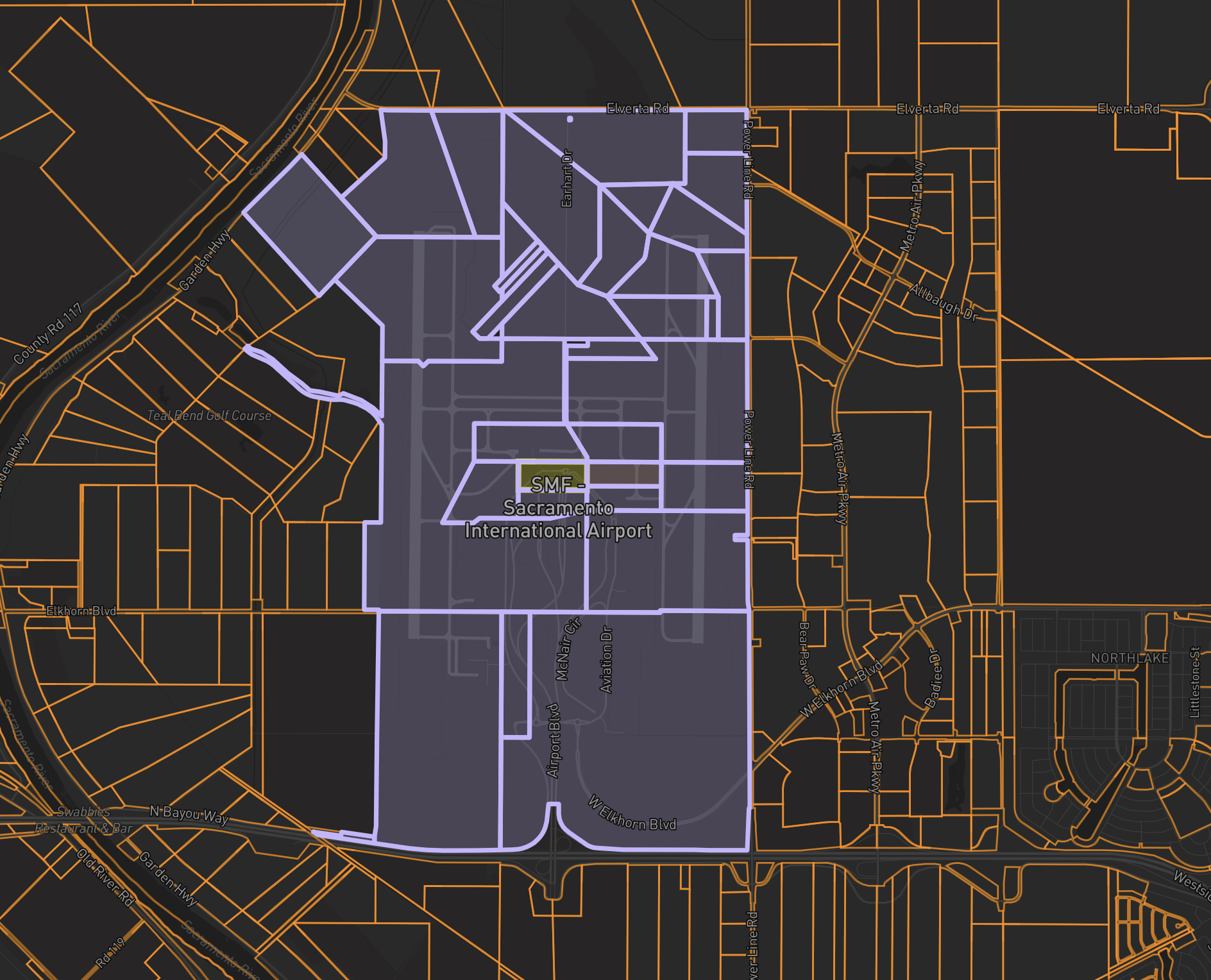
The purple footprint shows the actual same-owner assemblage around Sacramento International Airport on the Dark basemap. Pillar identified 38 parcels owned by County of Sacramento. The yellow parcel is the selected starting parcel; no two-owner grouping is enabled. Review contiguous ownership and the combined footprint before deciding whether a group forms a workable site.
Environmental acreage#
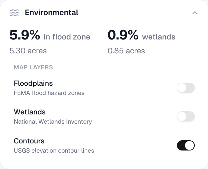
Included on Free. Compare source acreage estimates for flood and wetland constraints. Extents can overlap; these values are not a permit or a field assessment.
Contour intervals#
Floodplain and wetland map layers are Free. Contours at 9 ft, 15 ft and 33 ft are also Free. The finer 3 ft and 6 ft intervals require Pro and are included with the free trial, Pro monthly and Pro Annual. Select a locked interval to review Pro; your current map stays visible. When a Free account has a saved fine interval, the map displays 9 ft contours.
Slope analysis#
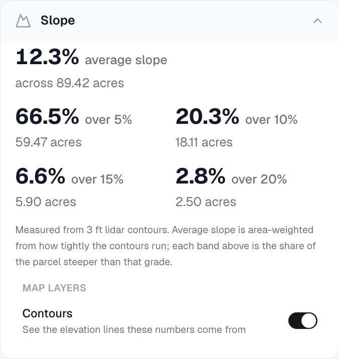
Inspect the slope distribution across the boundary. The screenshot shows the measured bands for the example parcel.
Last sale#
Read the available last-sale date and price. A source record may be incomplete or may represent a non-market transaction.
Valuation and tax#
Compare available land, improvement, total-value and tax fields. These are source values, not a fresh appraisal or a tax estimate.
Land and building details#
Review available land-use, building footprint, count, year-built and story fields. Not every parcel has every field.
Plans and limits#
See Plans and limits for current Free, trial, Pro and Pro Annual allowances. The app checks your current access before a paid action.